
Find Homes Along Aiken Streets
A useful street-by-street search begins with place, not a name. First preserve the street number, directional suffix, unit, city, and ZIP exactly as shown on the source in hand. The USPS ZIP Code Lookup can confirm a deliverable format, although a postal result never confirms who receives mail there. Next, use the Aiken County property route to connect the address with a parcel and legal description. Those identifiers make the move to recorded land records much safer than trying to treat a street name as a list of people.
- Normalize the known address with USPS, retaining the returned postal format as an address observation only.
- Search the Aiken County property system by address, then save the selected parcel number, situs address, legal description, and report date.
- Use the Aiken report's map route and Aiken County road, subdivision, and parcel searches to confirm the physical parcel in context.
- Search the Aiken Register of Deeds by the recorded party or by book and page, then match the record date and property description to the parcel.
- For a dated Aiken household clue, consult a documented directory or phone-book volume and label the entry by its year and role rather than calling it a current resident record.
That sequence answers a property-record question. It does not turn an owner field, mailing field, or a land-record party into proof of present occupancy. A full historic directory shelf belongs with the Aiken city directory collections, where the dated volumes and their limits can be read in context.
qPublic Paths for Aiken Streets
The County's instructions for Aiken County Real Property Information and Maps identify four starting paths. Each solves a different problem. Address is the natural route for a by-address inquiry, while parcel number and legal description preserve continuity when a street label changes or a subdivision is involved. Owner Name is useful for a recorded ownership question, not for establishing a household. A selected result leads to a Report, and its Map link locates the selected property.
| County search mode | Input type | Required | Verified use |
|---|---|---|---|
| Owner Name | Text search | No | Aiken property-account navigation by owner name. |
| Address | Text search | No | Aiken address-keyed path to the property account. |
| Parcel Number | Text search | No | Aiken parcel navigation; older formats can use the County conversion route. |
| Legal Description | Text search | No | Bridge to Aiken deeds, plats, and subdivision records. |
| Report then Map | Result selection | Not applicable | Aiken County-documented path from a selected result to the map location. |
The hosted Aiken qPublic property search was protected during research inspection. Aiken County instructions verify these inputs and the Report-to-Map path, but do not publish a complete public parcel-card field list. Treat any completed Aiken report as the record to inspect, rather than assuming it has a particular value, exemption, sketch, sale, or mailing field.
Aiken Street Map Tools
Aiken County GeoServices manages the County GIS enterprise geodatabase and 911 addressing outside incorporated North Augusta. Its Maps page links the Beacon property map and documents Property Search, County Address Search, Subdivision Search, Road Search, and Parcel Search. The viewer also has a layer list and legend, with optional administrative-boundary, emergency-response, environment, and grid groups. These tools give an Aiken address search spatial context without changing the meaning of the underlying record.
Use the Aiken map to identify a parcel and a road relationship, then verify an Aiken property question through the assessor or ROD source. County instructions do not document a radius, buffer, adjacent-name, or export control. GeoServices imagery and colors are useful navigation aids, not a survey or an ownership decision. When an old Aiken road, rural route, or driveway does not match the current parcel, use the GeoServices or 911 Addressing correlation process rather than a nearby modern address.
Aiken Street Directory Land Trail
The Aiken County Register of Deeds is the confirmation stage after a parcel search. Its public index has two routes: name or business criteria, and book and page. In name mode, the required field is Last Name or Business; First Name, document type, and beginning and ending dates can narrow the search. In book/page mode, both numeric fields are required. The returned grid identifies Image, Record, Last Name, First Name, Record Date, File Type, Book/Page(s), and Property Description.
The Aiken ROD Documents search is not a street-address search. Match an Aiken party, book and page, date, and property description back to the parcel and legal description before treating a result as part of the same land trail. The County says some ROD-custody material, including powers of attorney, bankruptcy, mechanics and HOA liens, and specified tax-lien and federal-judgment material, is not available online. A blank Aiken web result can therefore require the counter, books, or an archive route.
The County's Register of Deeds information identifies the office that keeps deeds, plats, easements, covenants, mortgages, and related land instruments.
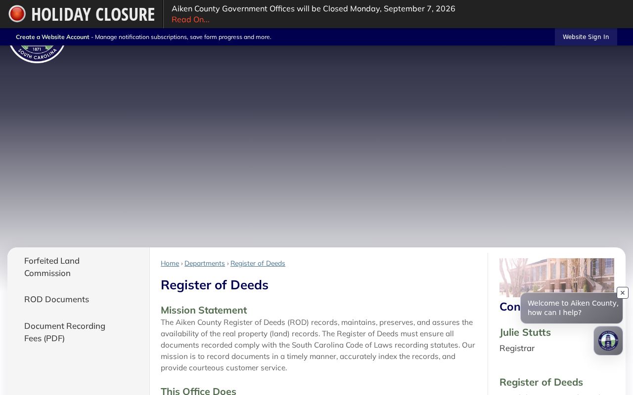
That office role matters because the recorder tracks a recorded land transaction, while the assessor and GIS layers help navigate the address and parcel that must be reconciled with it.
Aiken's 1982 and 2005 Access Cutovers
Three dates define the useful numbers in an Aiken land trail. ROD office records reach 1872. The County describes the online index as beginning in 1982. It also says documents recorded after June 12, 2005 are electronically imaged and viewable on ROD-office computers, while earlier material remains in book form. Those dates describe access layers, not proof that every document or image is available in the same way.
For a pre-1982 transaction, move from the web index to the ROD books or the South Carolina Department of Archives and History's Aiken County conveyance books, which cover 1872 through 1951 on 131 microfilm reels. Post-2005 office images are another documented route. Keep the date with every result, because a parcel may remain the same while the available search channel changes.
The public ROD search form shows the name and book/page alternatives used for its online index.
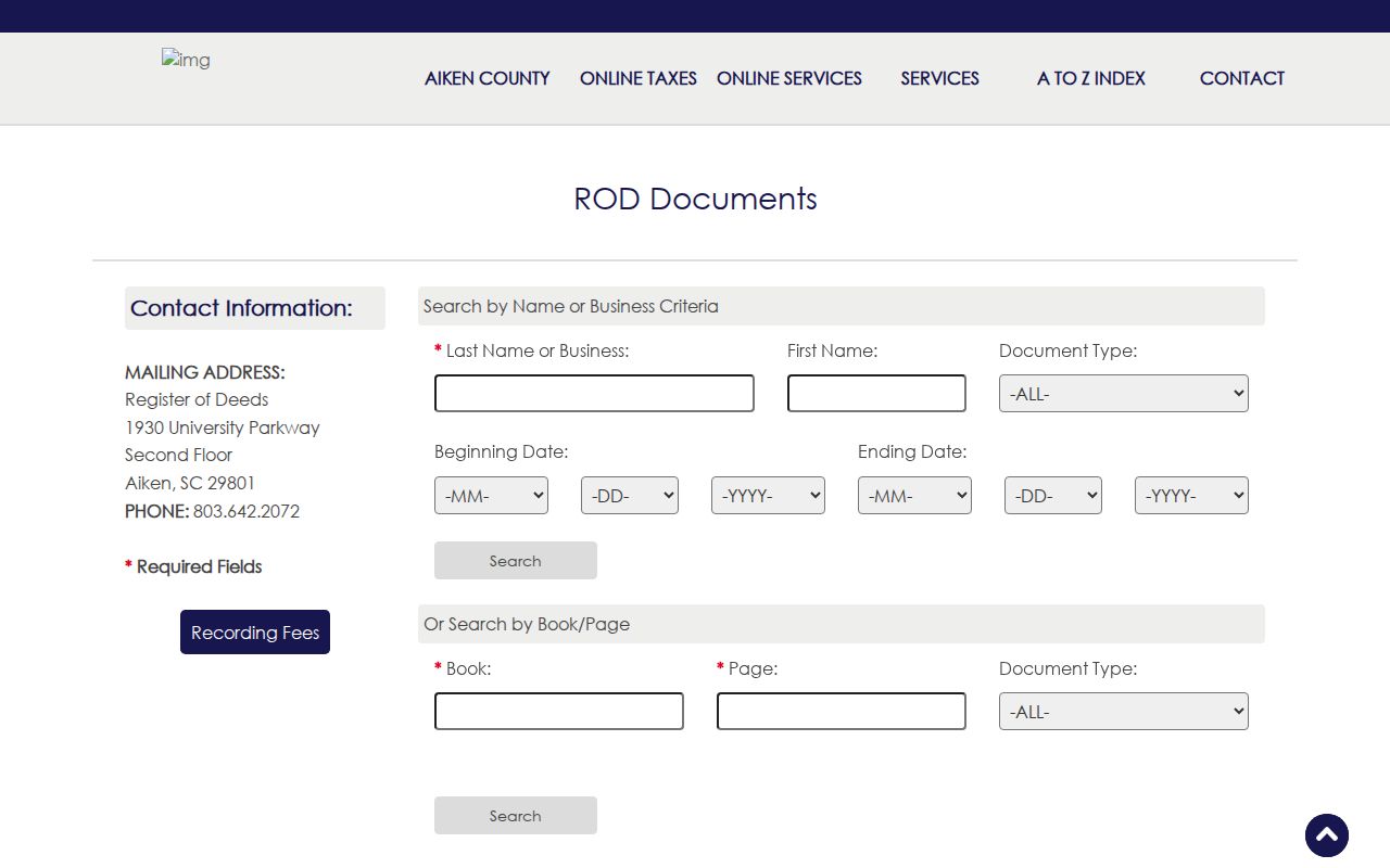
The form makes the limitation visible: recorded-land research moves through party and book/page fields, then back to the address and legal description saved from the property record.
Aiken Street Directory Record Coverage
Address-keyed sources overlap, but they do not say the same thing. The strongest Aiken address-record chain uses a parcel account for navigation, the GIS map for spatial context, and the ROD record for a recorded land event. Older city series and historic maps add date-specific context. The table keeps the record role and access route together, which prevents a street search from being overstated as a resident roster.
| Address-record source | Custodian | What it can establish | Access channel |
|---|---|---|---|
| Current property account | Aiken Assessor / qPublic | Aiken parcel navigation, owner/account context, and map connection. | Aiken web search, Assessor counter or phone, and GeoServices. |
| GIS property map | Aiken GeoServices | Aiken parcel, road, subdivision, and layer context. | Aiken Maps hub and Beacon viewer. |
| Deeds and plats | Aiken ROD / SCDAH | Aiken recorded party, record date, book/page, and property-description trail. | Aiken index, counter, written request, or historic reels. |
| City permits | Aiken City / SCDAH series | Known Aiken application or historic improvement context. | Aiken application-number portal, custodian request, or archive. |
| Water, sewer, tax, and directories | SCDAH / Aiken Historical Museum | Dated Aiken applicant, taxpayer, subscriber, or listing evidence. | Aiken archive request or in-person consultation. |
| Sanborn and aerial records | Library of Congress / SCDAH | Aiken physical building and street pattern for a named year. | Aiken digital map and archive catalogue route. |
Each row needs its own date and source role. A water applicant, taxpayer, listed subscriber, recorded grantee, and a person shown on a map-related record are not interchangeable labels. Note: A parcel number and legal description are usually the clearest bridge between a modern address search and a recorded land index.
Aiken Street Permit Numbers
City permit context belongs in by-address research only after a record has been identified. The public City Click2Gov screen exposes Application Year and Application Number, both numeric entries, then a Continue control. Research did not find an address, owner, contractor, or street browse on that screen. An address-wide permit claim would therefore exceed what the public portal documents.
For a known permit, use the Aiken City Click2Gov permit route. Otherwise, contact Aiken City Permitting/Codes with the address, timeframe, known application number if any, and record type, or make a focused records request. The Aiken City holds current permit, inspection, business-license, and code records, while SCDAH lists historic building-permit volumes for 1925 through 1936.
The captured Aiken City Click2Gov permit screen documents the narrow application-number path.
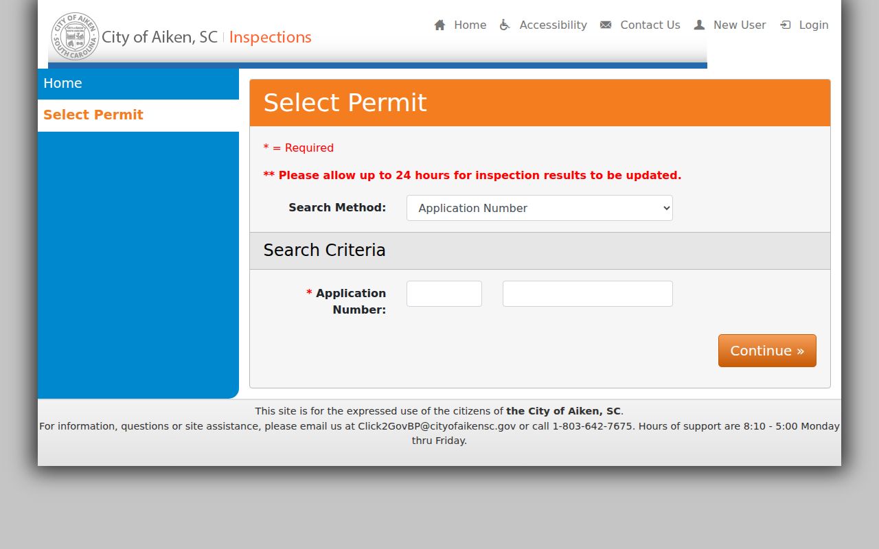
That limitation protects the distinction between a single identified permit and a broad search for information about everyone connected with an address.
Historic Maps for Aiken Streets
Historic Aiken street work needs a year-specific layer. The Library of Congress makes the 13-sheet July 1909 Aiken Sanborn map available, and SCDAH lists a 1918 fire map plus 1951 and 1952 aerial surveys in its City of Aiken guide. These Aiken materials can help compare a building footprint, street pattern, or physical use at a stated time with a current parcel. They are not name indexes and do not establish a household at the location.
Pair a selected map year with the deed legal description, a dated phone book or directory, a municipal tax or water record, or an identified permit. The Aiken County Historical Museum holds documented city directories for 1956, 1960, and 1966 and phone books for listed years from 1982 through 2017. A source may show a subscriber, taxpayer, service applicant, or land party, so record that role rather than merging it into a single claim about who lived there.
Aiken Street Record Terms
Street research becomes easier when the words in the record are kept separate. The County property and deed systems use location, parcel, and land-description terms for different functions. Saving them together gives a researcher a way to revisit the same tract even if a later source uses a different address style.
- Parcel
- A mapped property unit used for assessor and GIS navigation.
- Situs address
- The physical parcel location used in assessment and map work.
- Legal description
- The lot, subdivision, block, or metes-and-bounds language that ties land records together.
- Plat
- A recorded map or plan that can supply subdivision or boundary context.
- Criss-cross directory
- An address-arranged directory format, if a local volume includes one.
A mailing address, when a property report displays one, is correspondence information and may differ from the situs. It should not be used as an occupancy conclusion.
Aiken Street Directory Voter Limits
South Carolina's resident-facing MyscVOTES check asks for a name, county, and date of birth as printed on the voter card. It is a personal verification route, not a public Aiken by-street tool. The official voter-list channel has a different eligibility rule: a purchaser must be a registered South Carolina voter, and the listed filters include county, districts, age, sex, race, household, participation, and registration date. The published choices do not list street as a criterion.
That distinction matters for an Aiken road or block inquiry. Do not promise that an Aiken road or block can be converted into a voter roster. An individual self-check that does not return a result also does not prove a person is absent from Aiken or has no lawful address. Aiken historical research has other routes, including SCDAH voter stubs and precinct lists, each with its own date range and access condition.
Aiken Street Directory Fallbacks
When the Aiken online record stops, use the documented Aiken custodian route. For Aiken property questions, qPublic and Beacon are joined by the Assessor at 803-642-1583, GeoServices at 803-642-7592, and 911 Addressing at 803-642-2054 for official address validation. For an Aiken deed copy or index question, use the ROD web search, its Suite 2100 counter at 1930 University Parkway, phone 803-642-2072, or a written request. The County FAQ lists $5 for a written-copy request, with final pages and certification charges to be confirmed before payment.
Aiken County FOIA is the general fallback for Aiken County-held nonexempt records that are not online. Send a focused Aiken request to the actual custodian when a record is held by an independently elected office. State law allows inspection, copying, or electronic transmission of nonexempt records and allows certain actual search, retrieval, and redaction costs. The Aiken Historical Museum, ABBE library microfilm, and SCDAH are the better routes when the need is a dated Aiken historical record rather than a current administrative file.
Aiken Street Directory Privacy Limits
An address, parcel, and recorded deed do not disclose a household roster. Non-owner household members, delivery recipients, utility information, protected addresses, and many sensitive court or family records must remain private. Aiken address research should also keep owner of record, mailing address, situs address, recorded party, and historic subscriber as separate roles. Courts have removed home addresses from the online Public Index beginning in 2026, and protected information must not be rebuilt from surrounding records.
South Carolina's Address Confidentiality Program provides a substitute address for qualifying survivors, while a 2026 privacy process allows qualifying judges and certified law-enforcement officers to seek removal of specified personal details from government websites. For an error, retain the record identifier and contact the responsible custodian. For an immediate threat, call 911 rather than using public sources to trace someone.